Enter a name, company, place or keywords to search across this item. Then click "Search" (or hit Enter).
Collection: Videos > Speaker Nights
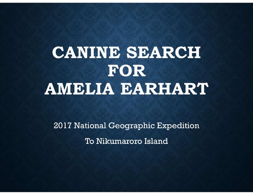
Video: 2022-04-21 - Caine Search for Amelia Earhart with John Grebenkemper (66 minutes)
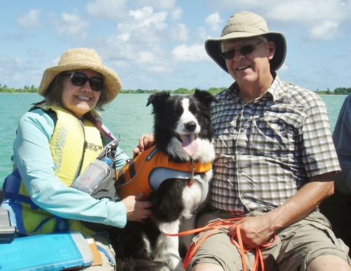
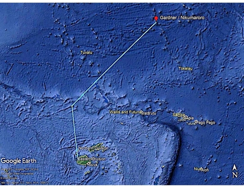
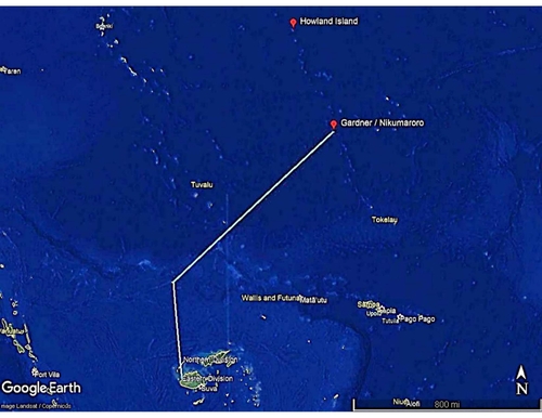
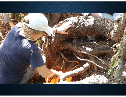
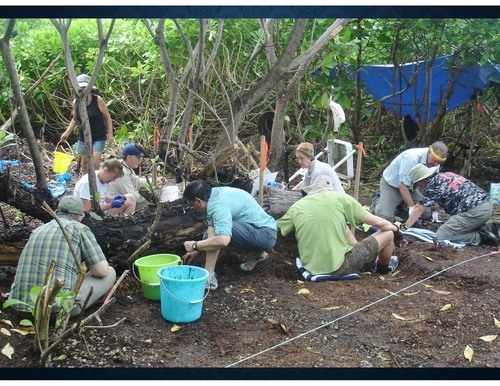
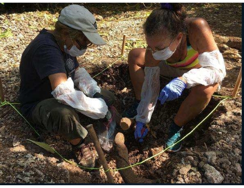
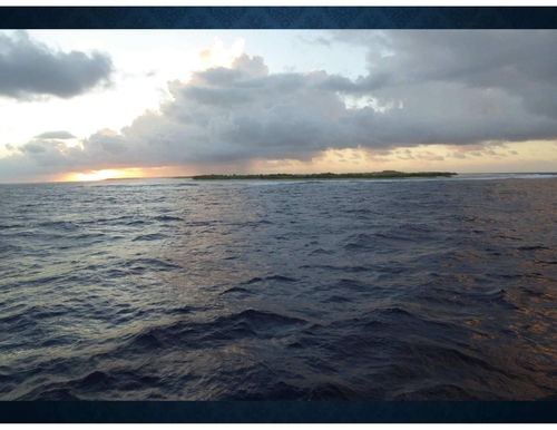
In 2017 the National Geographic Society sponsored an expedition to the South Pacific to look for the remains of Amelia Earhart on an uninhabited island near the equator. Included in this expedition were four dogs specially trained to find old human remains. The expedition flew into Fiji and then boarded a ship for the 1100 mile trip to the isolated island of Nikumaroro.
This lecture will follow the difficulties of getting dogs into the Rabies free zone in the Pacific and working them in the tropical heat and humidity while surrounded by local wildlife who had never seen a dog. We will also show why Amelia Earhart and Fred Noonan could have landed on this island 400 miles from their original destination of Howland Island. There will be numerous photographs from the expedition. Presenting will be John Grebenkemper and Kayle (who did all the actual work on the search!)
This lecture will follow the difficulties of getting dogs into the Rabies free zone in the Pacific and working them in the tropical heat and humidity while surrounded by local wildlife who had never seen a dog. We will also show why Amelia Earhart and Fred Noonan could have landed on this island 400 miles from their original destination of Howland Island. There will be numerous photographs from the expedition. Presenting will be John Grebenkemper and Kayle (who did all the actual work on the search!)
Author: John Grebenkemper
Published: 2022-04-21
Original Held At:
Published: 2022-04-21
Original Held At:
Full Transcript of the Video:
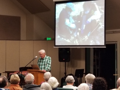
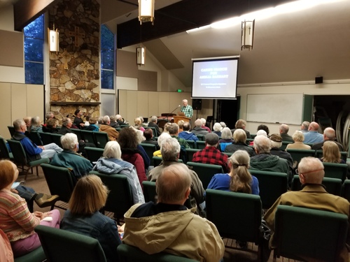
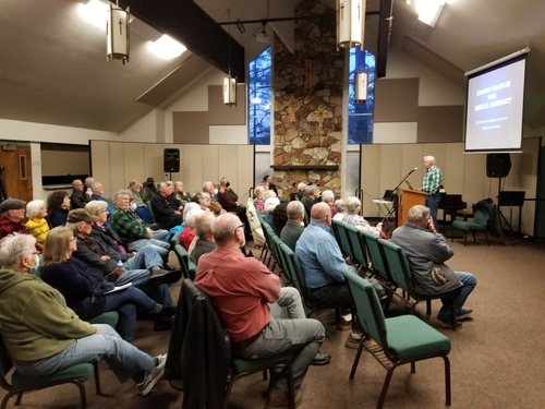
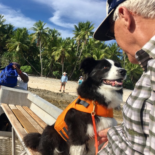
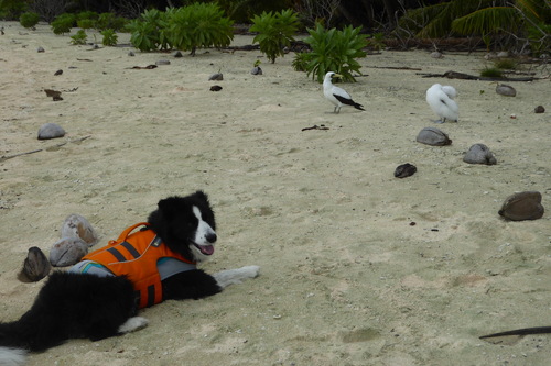
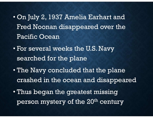
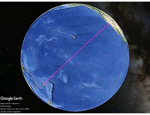
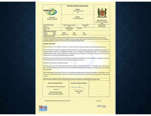
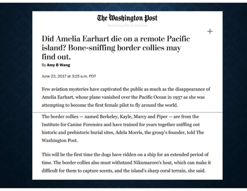
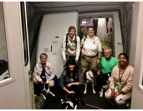
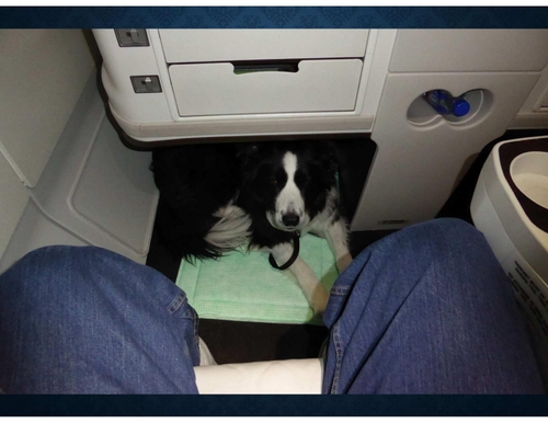
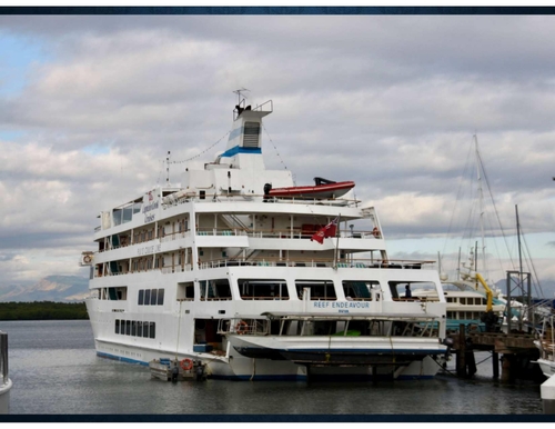
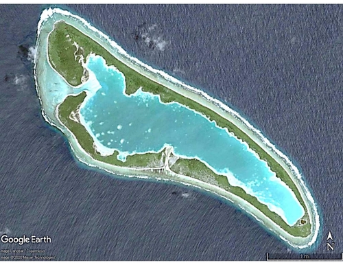
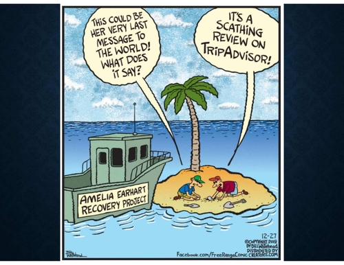
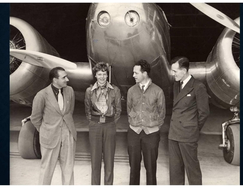
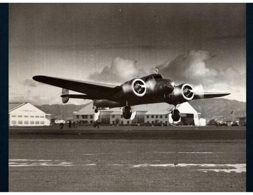
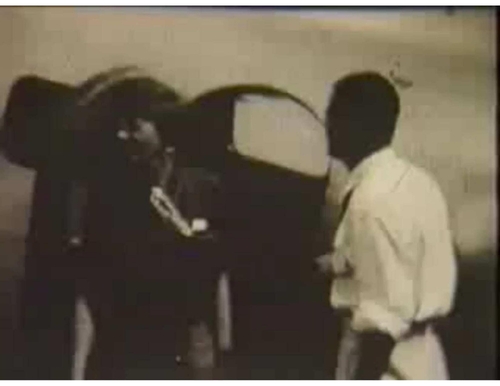
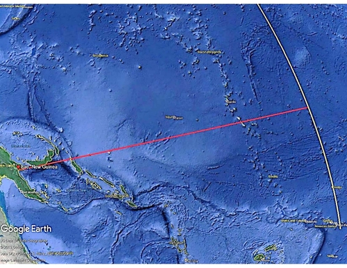
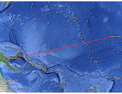
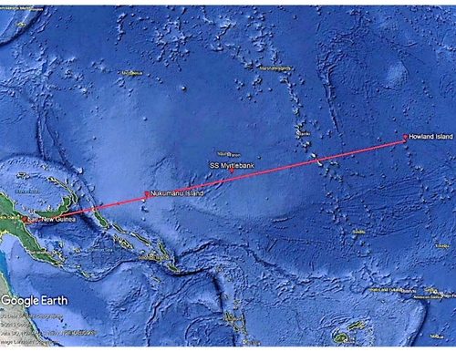
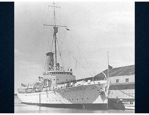
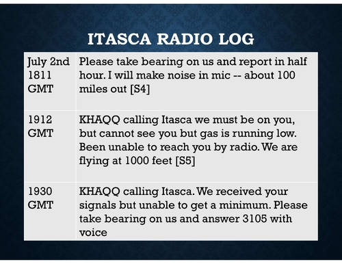
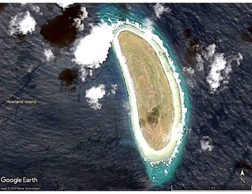
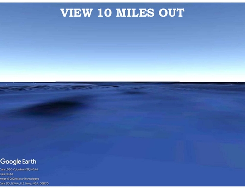
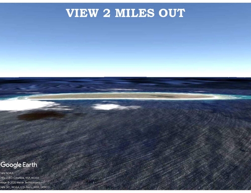
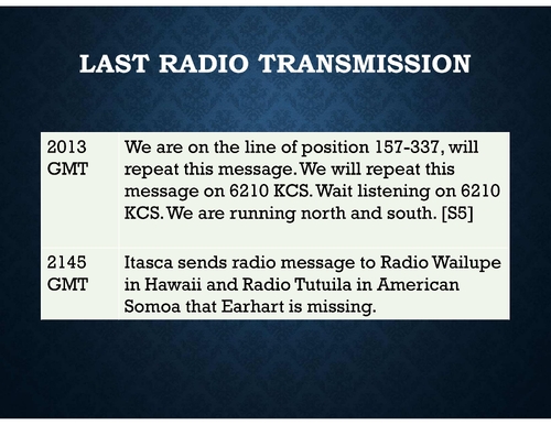
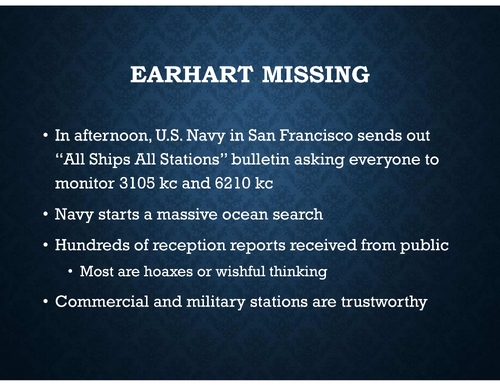
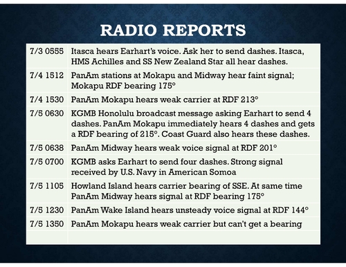
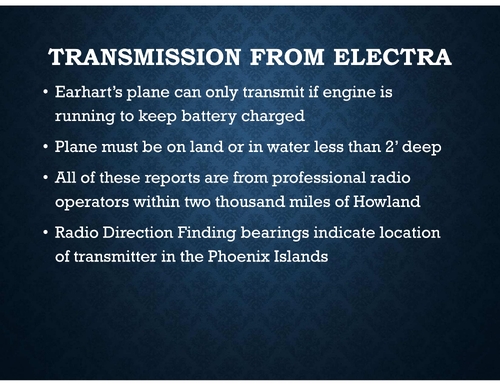
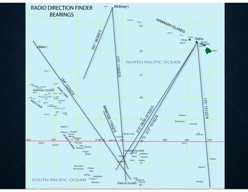
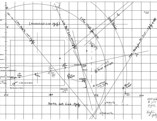
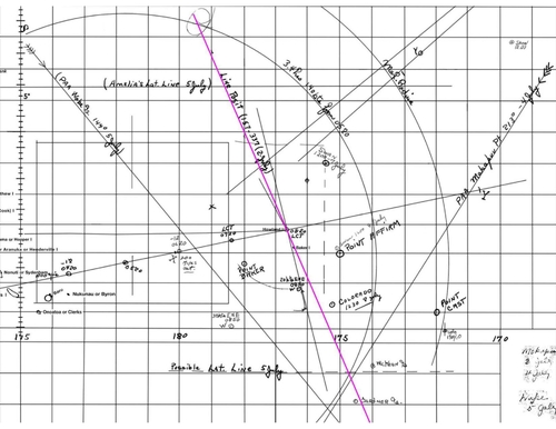
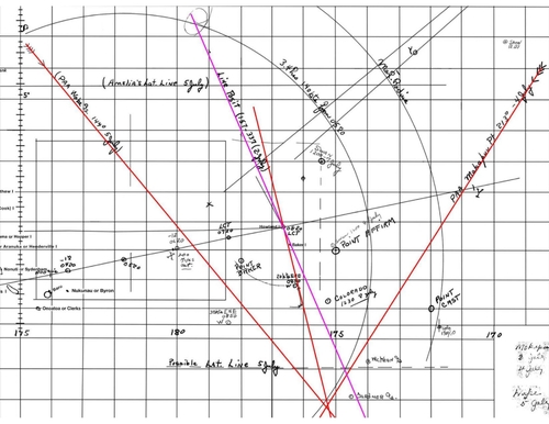
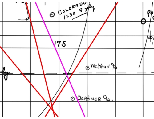
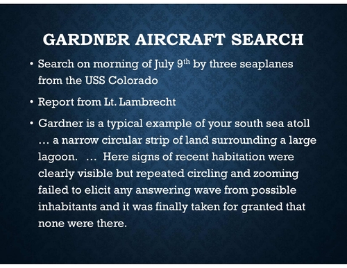
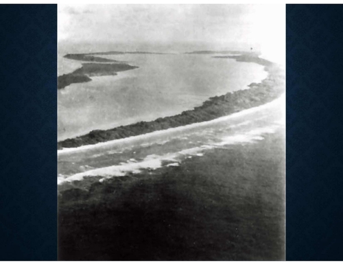
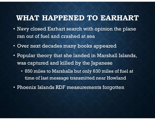
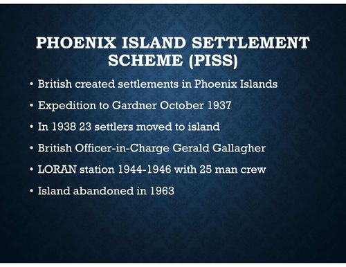
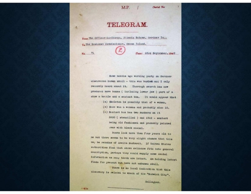
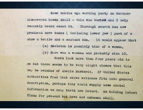
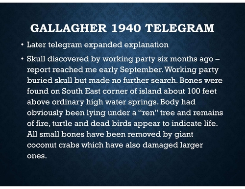
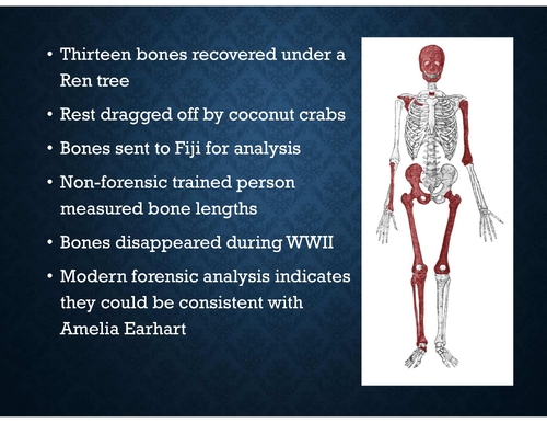
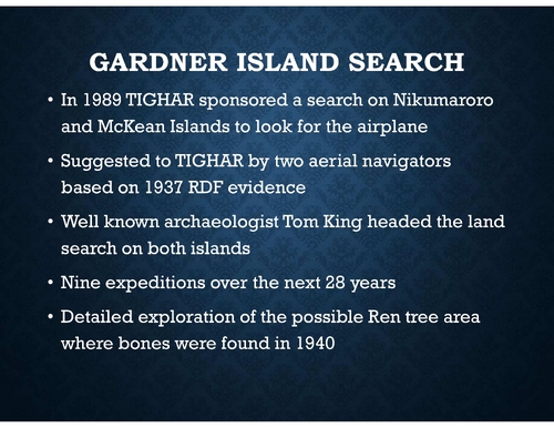
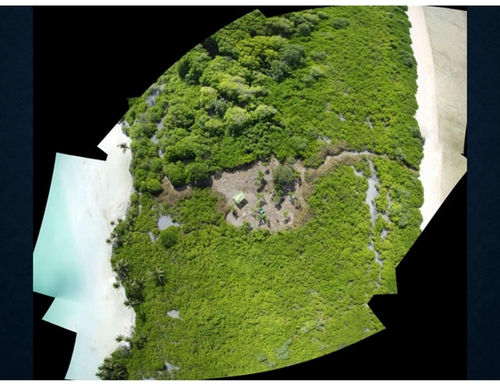
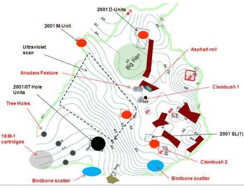
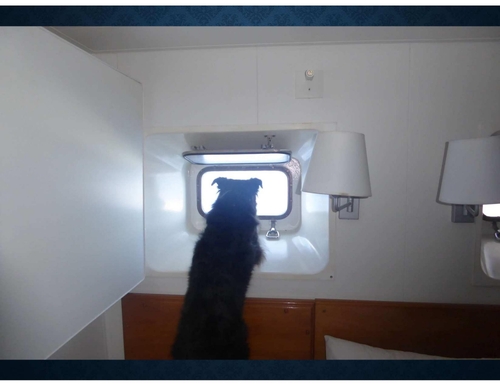
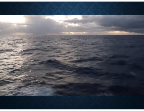
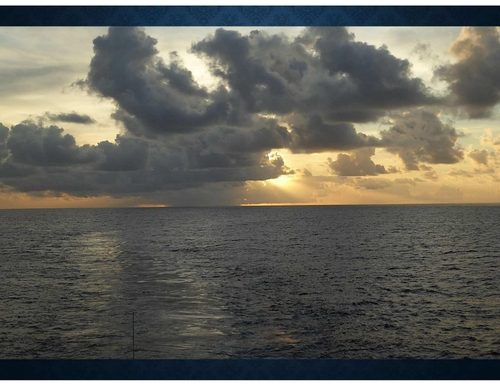
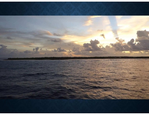
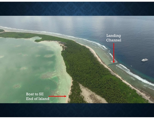
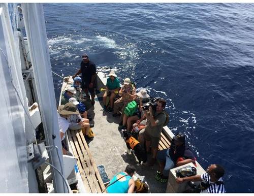
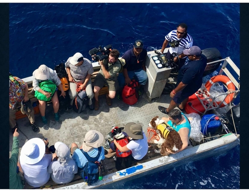
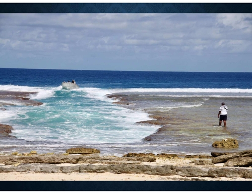
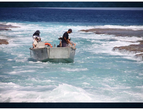
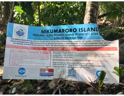
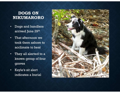
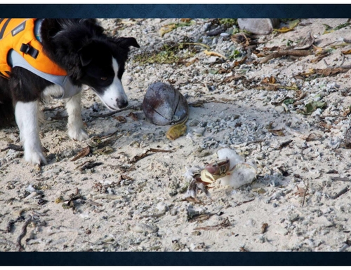
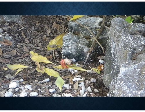
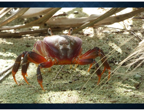
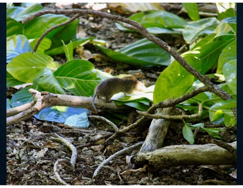
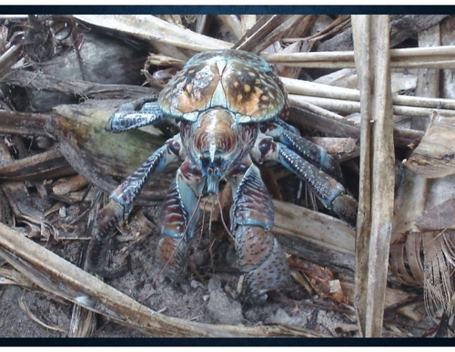
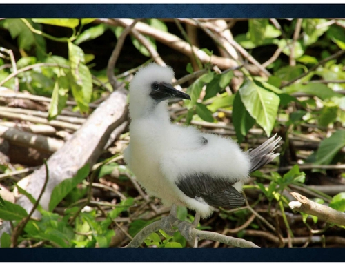
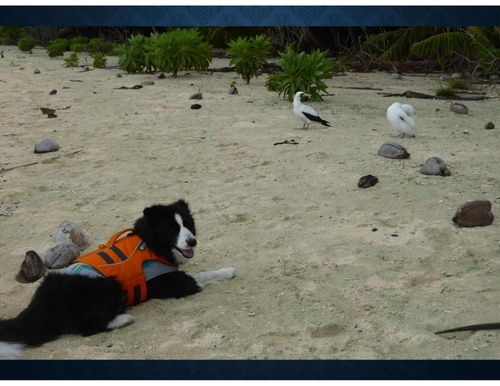
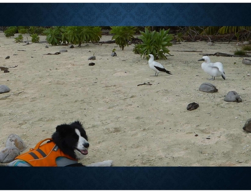
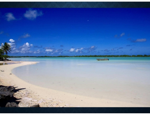
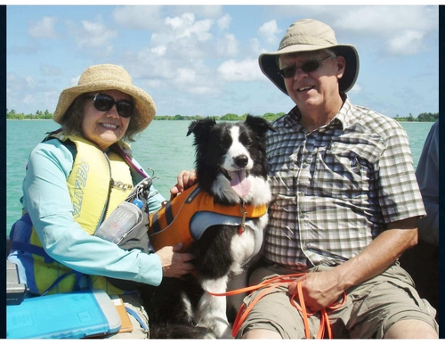
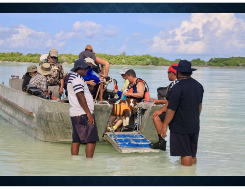
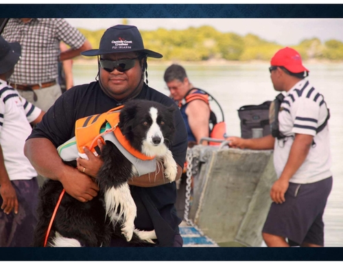
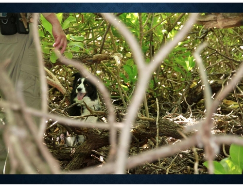
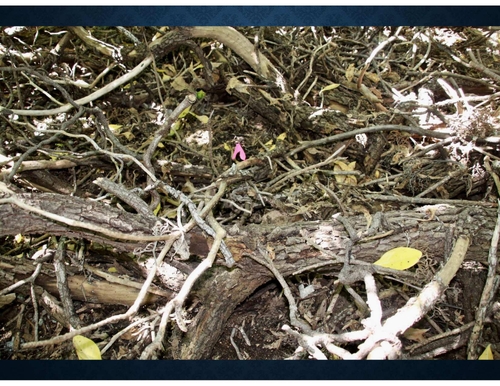
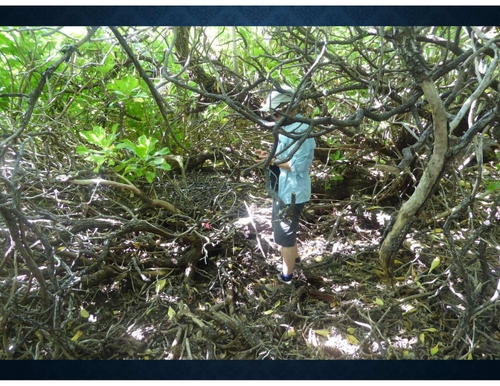
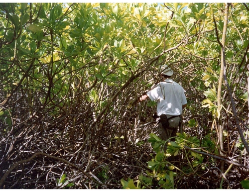
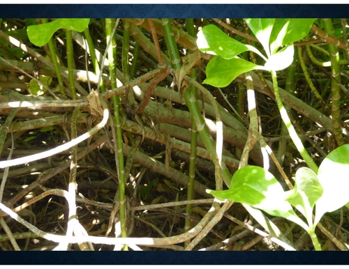
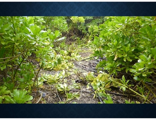
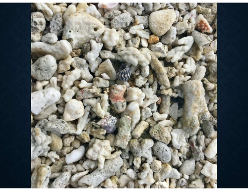
So back to tonight's presentation John Raven-Kimper. Close, close. Okay, he's here with us along with his featured presenter Kaylee. John has been here before and he talked last a couple of years ago, I was going three or four or five years about the Donner party cabin site study you did up there. It was most interesting. His presentations were always spectacular. I think we're going to see a lot of graphics probably and pictures and what else? Let's picture. Let's picture. Good. So John, welcome. Okay, can you hear me? No, it's not on. Oh, secrets. How's that? Yeah, what Dan didn't mention is this talk is two months, two years and one month late. It was originally scheduled for March of 2020 and some strange things seem to happen around then. So what I'm going to talk about is in 2017, the dog who's up here being baby sat and I went on an archaeology expedition sponsored by National Geographic Society to look for the human remains of Amelia Earhart. In archaeology, it's always important to understand the history of the site you are investigating, particularly when you're heading off into the Pacific with a dog. It's pretty good to understand that they have a chance of finding something. So this talk will explore Amelia Earhart's disappearance, how she could have reached Nicomero Island and evidence that indicates she may have died there. This all works. We've got the next slide. This is a mystery story. What happened to the famous aviator Amelia Earhart and navigator Fred Noonan when they disappeared on July 2, 1937. There have been hundreds of books published about the disappearance, but most of them are more fiction than fact. Many of these books allege that the government is covering up the Earhart disappearance. After an extensive search in July 1937, the Navy concluded that she ran out of fuel and crashed in the ocean. That is certainly believable considering that she was trying to find an island about a mile in length in the middle of the vast Pacific. This story is an alternative theory. To prove it, this expedition will either have to find human remains with DNA from Amelia Earhart or Fred Noonan, or part of the missing airplane, Lockheed Electra 10-E. By disappearing, Amelia Earhart became more famous than if she had completed the flight around the world. In January 2017, my search group began discussions with the National Geographic Society to bring the search dogs from the Institute of Canine Forengics to an isolated uninhabited island in the South Pacific. There were some previous archaeology investigations that indicated a Western woman was stranded on this island in the 1930s. While the investigations were suggestive that it could have been Amelia Earhart, there was no positive proof. If the expedition could recover human bones detected by the dogs, they might be able to extract DNA and make a positive identification. It is pretty trivial for a human to fly from the United States into the South Pacific. It is extremely difficult to fly a dog. The area is a rapier-free zone and no country there allows a dog to enter from the United States with an extensive medical test and a long quarantine. Just getting permission for canine entry is going to be a difficult proposition. We signed a contract with National Geographic to supply four handler canine teams for the expedition. National Geographic will pay all the expenses and use their international contacts to help influence the countries involved to allow entry for the dogs. The expedition plan was simple. We take a non-stop flight from LA to Fiji and then hop on a boat for a five-day, 1,100 mile trip to Nicaragua Island. As shown on the globe, the flight to Fiji is a long flight that takes 12 hours. There are lots of big questions. How could we get dogs into Fiji? How do you have dogs live on a boat for three weeks? Do we get permission to land the dogs on the Cúmeroro, which is a World Heritage Site and Wildlife Preserve? Would the charter boat company allow dogs unborn? Last question was the easiest to answer. The charter boat company said they would love to have dogs travel with them, but we could never get permission from the government of Fiji to get them into the country. I don't think they ever suspected they had just committed to carry four dogs on their ship. So how do you get dogs into Fiji? There's a 10-page document with lots of subsections that describe all of the medical tests that need to be performed before submitting your application for recording a dog to Fiji Bio Security. If that is approved, you can then have the animal air freighted into their quarantine facility where it will spend several months before release. Fiji requirements are so strict that dogs from other countries in the Ravage Free Zone require minimum quarantine of 10 days. This was not going to be easy since we will not air freight a dog and would not subject them to quarantine. If you want to take a dog to Fiji, expect many visits to the vet for all sorts of tests you have never heard about. The four dogs shown in the picture here and their handlers got to know the chief vet very well. The cost per dog was about $3,000. It takes about three months to go through the full process and submit your paperwork to Fiji Bio Security. We also had to deal with an issue of dog food. The only dog food available in Fiji is so bad you wouldn't want to feed it to a human. It is illegal to import dog food from the US so we couldn't fly it on the plane. However, Fiji would allow us to import it from New Zealand and New Zealand makes a nice premium dog food. And we had some air freighted into Fiji. The custom duties for that cost us a thousand dollars. We were scheduled to fly to Fiji in June 22nd. Just to keep things interesting we had a new problem. Fiji Airlines is not permitted to fly animals in the passenger compartment. We wouldn't put them in luggage. So they had to get special permission from the government. They wanted lots of information about dogs flying in airplanes. And it was just at that time in a recent incident in the US a dog had bitten another passenger. The first permit to import livestock into Kiribati arrived in June 6th. You know she was considered livestock. They didn't have any way of importing dogs. We could land on Nuku Marora with the dogs but we still need an entry to Fiji and we were down to a week before departure. I left to drive down to LA not even being a hundred percent sure that where this trip was going to happen. The final approvals came through the day I left for LA. The dogs would be permitted to enter Fiji without quarantine. And Fiji Air was given permission for the dogs to fly in the passenger compartment. I carried several copies of the magic form up there because it proved the dog was illegally in Fiji. Meanwhile National Geographic has harnessed a secrecy about the strip. Until of course they did a press release the morning of the flight to Fiji. And you know after months of secrecy it really looked like we were going to get four dogs to visit an uninhabited island in the South Pacific. The four border colleagues got their 15 minutes of fame in the newspapers around the world including places like the UK leading newspaper, Germany, India, Japan. You know we got it got the word got around. Because they went through the LA Airport later that day a number of people stopped me and the dog and asked if we were going once flying off to look through Amelia Earhart. When I said yes they whipped out their phones and took a picture. At the airport Fiji Air had a special person assigned to escort us through the check-in process. Once they decided they would fly dogs in the airplane they gave us the VIP treatment whenever we were flying in one of their planes. We were boarded early. Pictures were taking through the Fiji Airline newsletter of dogs boarding the airplane. Four dogs were off to travel a quarter way around the world. And this is Kelly. She goes under the seat in front of me and enjoys herself. The airline even got special pads for the dogs to sleep under the seat under the 12-hour flight. Kelly spent most of the time sleeping and that's fortunate because there's no doggy bathrooms on the airplane. When the plane arrived in Fiji customs had set up a special line just for the four dogs which passed us through quickly through the system. The other 250 passengers had to wait the normal customs line. We spent one night in Fiji at a resort hotel to allow us to somewhat adjust to the time and humidity. It wasn't just hot temperature wise but it is really humid. The reef Endeavour is a 300-foot ship designed to carry a hundred passengers in the crew of 50. It is normally used for luxury cruises around Fiji. But this time it would be crossing the open Pacific. Most of the 50 passengers were ecotourists who paid lots of money for the special trip to visit the island where Amelia Herhart may have died. The island is only open for approved scientific expeditions and this trip was led by well-known archaeologist Tom King who would supervise further explorations. Well the island was known as Gardiner Island in the days when Amelia Herhart was there. And way up there, we're way down here, they actually did a little detour to drop supplies off at an outlined beachy island and then went up to Gardiner. And as part of the nation of Kiribati, now known as Nikumaroro, and for those of you who may not recognize the name Kiribati, it's spelled people around here say Kiribati. Not true because then the typewriter where they were doing the official documents for the name didn't have a working S so they put a TI. The 1,100 mile trip of the boat is equivalent taking a boat from San Diego to Seattle. The nearest inhabited island from where we were going was 300 miles away with a population of 20. The nearest hospital is 600 miles. If someone was seriously injured it would take three days to get them to the hospital. It isn't like you can just fly a plane up there, there's no place to land it. This is the island. Nikumaroro, four miles long, one mile wide. The interior lagoon is a shark nursery. The highest point in the island is about 50 feet above sea level, but most of it's about 10 feet. This is not a tropical paradise. There's no flowing freshwater in the island and the only inhabitants are birds and crabs. Nikumaroro is so isolated that more people have been on the top of Mount Everest than on the island. And I'll read it, probably can't read the cartoon, but it says the boat is labeled the Amelia Earhart recovery project. The first person says this could be your very last message to the world. What does it say? The answer is it's a scathing review on Trip Advisor. So Amelia Earhart was aiming for an island called Holland, which is way up there at the top of the map. And how could she end up down here? Oh, that's what we'll explore. I mean, Gardiner Island was 400 miles to the south southeast. And we have to really look at the history of the flight to understand how she got, could have gotten there. The original plan was for Amelia Earhart and navigator Fred Noonan to take off from Lake New Guinea in the morning and they would arrive at Holland Island the next morning. So it's a long flight. 2560 miles to be exact between the two points and require about 18 hours of flying time if there were no headwinds. They would pass over several small island chains that had never seen an airplane. The landing strip in Holland had been specially built by the US government for this flight. The Lockheed Electra-10E was a commercial airplane that would seat 12 passengers. Lockheed modified it for Earhart by converting the passenger department into a fuel tank. The plane carried 1150 gallons of gasoline, which weighs about 7,000 pounds. That gave the airplane a flying endurance of 24 hours. Kelly Johnson, leader of Skunk Works, Maine, calculated the exact power settings and altitude to give the maximum range. They were provided to Amelia Earhart as the recommended operating conditions for the long flight. Fred Noonan on the right would serve as navigator for which he had considerable experience for Pan American Airlines in the Pacific Clipper fleet. Next to him is Harry Manning who was the fly, the Pacific portion of flight both as navigator and radio operator. When the flight was delayed because of an aircraft accident he had to drop out leaving just Earhart and Noonan on the entire flight. This is the photo of the Electra taking off from Oakland. If you see there's a little antenna up here, a loop antenna, that's a radio direction finding antenna that steer the plane into small islands in the Pacific. When Manning dropped out either Earhart or Noonan were experienced with operating the radio direction finding equipment or sending Morse code on the radio transmitter, both of these skills would prove to be major issues on this flight. This is the last known film of Amelia Earhart and Fred Noonan taking off from late of getting. The plane departed about 10 in the morning local time which is really convenient because that's zero hours Greenwich mean time. Using local time on this flight is difficult because half hour time zones, the international date line and lots of time zone. So I skip times the GMT which is the elapsed flying time. And that's the last photo photograph. Navigating to a small island in the middle of the Pacific was a difficult task. During the nighttime and there wasn't cloud cover you could determine your latitude with star observation. Longitude was more difficult. The flight was set up so that sunrise would occur about an hour before the plane reached Holland Island. You could then measure the exact time of sunrise and that gave you the distance from the arc shown by the yellow line which is called the line of position. And what you do if you were determined you were here, you knew how long to fly and then you go either north or south to get to the island if you, if you thought you'd guess right or you can zigzag back and forth before we finally got to it. And you'll hear a flying in position mentioned several times. So what they did was they flew and you know they would determine their you know when sunrise was, get their longitude and fly to the line of position. And we don't know which way they turned. Whether they turned to the right or to the left. Here her reported by radio a position near Nikumandu Island at 0718 GMT. So it's Nikumandu. It's right there. Her reported flying altitude was 8,000 feet which agrees with the Kelly Johnson recommendations. This computes to an average ground speed of 125 miles per hour. The position reported in time is exactly local sunset so noon and apparently have been able to measure longitude from the setting sun. At 1030 GMT they were flying in the darkness. The error art reported to her radio she could see a ship below. This is positioned here. The deck watch on the SS Myrtleback reported to the bridge that he could hear an air flying. This would be a highly unusual event so far from land. The position of the Myrtleback shows that the average ground speed was 135 miles per hour and air was close to her desired course. More than halfway through the flight. This is the last known position that we have any confidence of over the flight. The Coast Guard cutter at Tosca was moored at Holland Island to provide support for Air Hearts plane. They have radio direction finding equipment transported to Holland Island to provide final guidance into the island. The radio room had been listing the air hearts transmissions as she transited the Pacific Ocean towards Holland. These radio transmissions provide what happened, give clues to what happened on the morning of July 2nd. So the local time in Holland Island is 11 and a half hours earlier in GMT so again all the times are in GMT which is the elapsed flight time. As I said at the beginning, they have 24 hours of flying time in the airplane. So Air Hearts sends a message at 1811 GMT, "Please take bearings on us and report it in half an hour. I will make noise in mic about a hundred miles down. " And there's an S4 in parentheses or brackets. The number of brackets is the signal strength on a scale of 1 to 5. S4 is a pretty strong signal. A little later, almost a little over an hour later, she's AH-8QQ calling at Tosca, "We must be on you but cannot see you. But gas is running low. If we're not able to reach you by radio, we are flying at 1,000 feet and the radio operator gives the strongest possible signal record at S5. Gas running low indicates that she was getting close to her reserve level which is about four hours of flying time. At 1,000 feet indicates that may have been local clouds forcing her down. The Atosca reported 20-mile visibility and no cloud cover at this time. The signal strength was so strong through radio operator thoughts you've been landing soon. " And then we have a message coming in a little bit later at 1930 GMT, KHAQQ calling at Tosca, "We received your signals but unable to get a minimum. Please take a bearing on us and answer 3105 with voice. " And that's the transmitting frequency they were using then. The minimum indicates that she was using radio direction finder but couldn't get a bearing from it. Earhart and Noonan's lack of experience using the RDS is becoming a problem. However, the Atosca has a radio direction finder in Holland to provide guidance. The crew running it has been listening to Earhart transmissions all night and at this critical time the batteries have run down and they can provide no directional guidance. Holland Island is small. Tell you about a mile in length. There are no trees which makes it difficult to see at low altitude. And we know Earhart reported she was at 1,000 feet. So this is what Holland would look like 1,000 feet, 10 miles out. It's right in here but you can't see much. Google Earth is so nice what you could do on it. And that's one of the reasons why radio direction finding is so important to locate an island. At two miles out, yeah, you can easily see the island. However, in 1937 navigating an airplane to within two miles of your destination after a 2,500 mile flight across the ocean was an impossible task. Well, this is the last radio transmission that was ever received. We are on the line of position 157337, the line of position I showed you earlier. They would fly along to look for the island. We'll repeat this message. We will repeat this message on 6210 kilocycles. Weight listening on 6210 kilocycles. We are running north-south. Again, the signal report was recorded as S5. And they're changing over frequencies because they normally use 6210 kilocycles for daytime transmissions. So the flying along line of position goes north and south. They switch to their daytime frequency of 6210 but the TOSC can't hear them and request Air Heart to switch back to 3105. There's no further response heard from the plane. With no word for one and a half hours, the TOSC declares the Air Heart plane is missing. The Navy sends their message requesting all commercial and military ships to monitor the Air Heart frequencies. Air Heart missing is a major story around the world. Soon there are numerous reports from people carrying Air Heart and their radios requesting help. The vast majority of these reports are hopeless or wishful thinking of what they heard when they heard the noise and the noisy hiss between radio stations. The only radio reports I trust are the ones that came from the commercial or military stations. There are a number of credible reports from these stations and the only way to air heart to transmit if her plane had landed intact on a nylon. And this is a whole listing of reports over a several day period. And these are commercial both military and commercial stations in the Pacific here transmissions of Air Heart's primary frequency at 3105. There are no other licensed transmitters in the Pacific on this frequency. This is the strongest evidence that Air Heart's plane survived the flight and landed intact. And especially when they're getting receiving these signals you know several days after she's disappeared. Atoska hears a transmission that evening, the evening she disappeared. The radio operator recognizes Air Heart's voice and asked her to send dashes that are heard by three other stations. Two days later in the early evening Honolulu broadcast station KGMB asked Air Heart to send four dashes which are heard by Pan Am and Coast Guard stations in Hawaii. KGMB repeats their four dash request a half hour later and dashes are heard in American Samoa. Over the next six hours there are various reception reports. All of these transmissions were at night in the Pacific. The Pan Am stations have radio direction finding equipment for receiving signals and was used for their navigating the Pan Am flipper fights across the Pacific Ocean. The Holland Island Art radio direction finder also was able to get a bearing. All of these bearings point to one area of the Pacific. And the other way those radio transmissions could occur is the aircraft landed intact. The radio transmission radio transmitter requires one inch of aircraft engine to run to keep the battery charged. And the multiple radio direction finding bearings indicate the plane is somewhere in the vicinity of the Phoenix Islands than a British possession. Most of the Phoenix Islands are uninhabited. So here we have on a modern map radio direction finding signals that they can find from all of the stations today. And you can see most of them converge in this area a little south of the equator. You'll get some. . . radio direction finding is pretty tricky. You can try to make a signal minimum but if the signal is weak it's very hard to get the direction. So you get a you can get a fair bit of error. So the question is did the Navy do a thorough search along the Phoenix Islands? So why didn't they? All of these bearings are available today but what did the Navy know in 1937? And we can answer that question. This is a map from the Navy headquarters at Pearl Harbor maintained by Errol Merthen's command. The last entry on the map is July 10th and it shows Earhart's flight path from Lee to Holland. It shows the line of position which is Earhart's last known bearing. It shows the position of the SS Myrtleback. So they knew that about that being heard. And it shows bearings of some of the RDF reports. The map didn't go below the equator so they taped handwritten edition below the equator. And those happen to be where the Phoenix Islands are. Gardner is on this hand-drawn one. You'll see it better in a couple of other pictures here. So this is the map of the Navy map that shows the line of position that the Navy knew about. The RDF bearings the Navy had on their map are, you can see them in red here. And they're all crossing down in this area. And if we look here, we expand that out. What do we have? There's the line of position she was supposedly following. The RDF bearings cross a little over here but not that far away from Gardner Island. Not too far from McKean Island. So considering the accuracy, you would assume that they're transmitting on Gardner or McKean. And we also see in this map there's the USS Colorado which is part of the search group. And that's their position on July 8th. Colorado carried three seaplanes that could launch from a catapult and search the islands for the missing plane. On July 9th, the seaplanes searched McKean and Gardner. They report that McKean is too small to land an airplane but a plane could easily land on the lagoon on Gardner. The lead pilot's report states, "Here signs of recent habitation were clearly visible but repeated circling and zooming failed to elicit any answering wave from possible inhabitants and it was finally taken for granted that none were there. " Well, Gardner did have no inhabitants at this point. The island is four miles long covered in thick tropical vegetation. The planes are flying at 400 feet. At that height, seeing a single person along 10 miles the beach would be difficult and the interior so that you couldn't see in through it. The total land area of Gardner is about 1,200 acres. The Lambert, the pilot, had pilot there could have landed his planes in the lagoon. And as recording states, "The lagoon at Gardner looks sufficiently deep and certainly large enough so that a seaplane or even an airboat could have landed on or taken off in any direction with little of any difficulty. Given a chance, it is believed that Miss Ergart could have landed her plane in this lagoon and swam or waded ashore. " And the Colorado search plane took a photograph of Gardner here. The tide is high. If an airplane had landed on the beach or reef, it might have been washed away by this time by the high tide. Research shows that the tide in Gardner was extremely low on the day Ergart disappeared. It stayed low for several days afterwards. This is called a neat tide and happens regularly in the Pacific. Why didn't the Navy conduct a ground search? Captain Friedel, commanding the USS Colorado, was placed in charge of the search by Admiral Murphin and left Pearl Harbor on July 3rd. While on his way to Holland, Captain Friedel was told about the RDF reports that Ergart's plane had to be on land in order to search the Phoenix Islands. On July 9th, the Colorado launched the three seaplanes to survey the King and Gardner. The Colorado proceeded to Gardner and actually drove along the north coast and took bearings on the island as they passed it. The Colorado then proceeded east to the rest of the Phoenix Islands and the seaplanes landed in Laguna and Hole Island when they saw native huts. On July 11th, Colorado was released from search duty. The Navy never did a ground search in either McKean or Gardner. Since they couldn't find Herhart, they concluded that she was lost at sea. A few decades later, the Herhart book started appearing. The theory that she was captured by the Japanese on Marshall Island gained a large following. At the time they were flying near Holland Island, they only had enough fuel to travel another 630 miles, whereas the Marshall Islands are 850 miles from Holland. The Atasca radio reports that Herhart's own navigation indicates that she was flying on the line of position near Holland. Now to go to the next step phase of this story. In 1938, the British decided to move settlers from the Gilberts into the Phoenix Islands, including Gardner. Yes, the project was really called PISS. The first exploration of Gardner was on October 12th, 1937, only three months after Herhart disappeared. The expedition explored Gardner for three days and decided it was a suitable location for a settlement. The settlement started late 1938. By 1939, there were 23 people living on Gardner. The Coast Guard Boran Station occupied the southeastern end of the island during World War II. The island did not support even a small population not assistance and was abandoned in 1963. However, a most interesting telegram was sent by Gerald Gallagher, the British manager of the PISS settlements. This is a copy of the original telegram. Gallagher on Gardner made it September 23rd, 1940. It created yet another mystery to be solved. And if we zoom in, I will read the interesting part of it. Some months ago, a working party on Gardner discovered human skull. This was buried and only recently heard about it. Thorough search has now produced more bones, including lower jaw, part of a shoe, a bottle, a sextant's box. It would appear that skeleton, possibly that of a woman. Shoe was a woman's and probably size 10. The bones look more than four years old to me, but there seems to be a very slight chance that this may be the remains of Amelia Earhart. If United States authorities find the above evidence fits into the general description, perhaps they could supply some dental information as many teeth are intact and holding latest finds for present but have not exhumed skull. These words were written three years, a little more than three years after Earhart disappeared. Second Gallagher telegram provides more details. Skull discovered by working party six months ago, the report reached me in early September. Working party buried skull, but made no further search. Bones were found on southeast corner of Island, about a hundred feet above the ordinary high water springs. Body obviously been lying under a rim tree and remains of fire, turtle, dead birds appear to indicate life. All small bones have been moved by the giant coconut crabs, which have also damaged larger ones. This shows that at least one person lived and died on Gardner for a period of time before 1938. They appear to be in a survival mode, cooking locally available wildlife on an open fire. And this is a diagram of the bones that were found of the 13 bones in 1940. The bones were sent to Fiji and measured by a person not trained in forensics. The bones then disappeared during World War II and multiple searches have failed to find their current location. Recent work with the initial major events indicate that they could be consistent with someone near Amelia Earhart's stature. However, they also could fit the stature of millions of other people. Not great proof. Nothing of interest happens for the next 50 years. In 1989, two old navigators suggested to a group called TIGER, which stands for the International Group for Historic Aircraft Recovery, that they should look for Amelia Earhart airplane in the Phoenix Islands because of the radio direction finding measurements from 1937. The search of McKean Island showed that a plane couldn't have landed on the island intact. It didn't have enough. Couldn't land on McKean Island intact. If it didn't land intact, it couldn't transmit radio messages. The exploration of Nikumaroro was inconclusive, but it was a big island and it couldn't be fully explored in one trip. The Gallagher telegrams were found in the old Western Pacific High Commission files of England and Terrawad in 1997. This led to an extensive search for the location of which the bones were found. A 1941 US Navy aerial photo identified a cleared area in the southeast corner of the island. This is likely the area cleared by Gallagher searching for additional bones and artifacts. So they started doing archaeology trips down there. And expedited, they extensively explored this site in 2001, 2007, and 2010. The area was cleared of education and showed in this aerial photograph. And numerous artifacts were found and curated. The ocean is on the right hand side and the lagoon on the left. The strip of land is about 600 feet wide at this point. And here we go. We have what some of the archaeology has shown. We have fire pits where wood could have been cooked. We have these features here, which indicate pits where plants were cooked. Bird bones scatter indicates where bones from the birds were thrown after being consumed. We have one parking visitor from the Coast Guard that was stationed in the nearby Loram facility. There are also a number of artifacts recovered from the 1930s where they're manufactured in the US. Zipper slide was found to the site. It was manufactured between 1933 and 1938. Bottle of Campania Italian bombs and motion, manufactured in the Navy Illinois in the 1930s. Advertising from the 1930s indicated that the body was primarily marketed to women. Tree labeled "big red" could be where the bones were found in 1940. Now let's look at some of the artifacts. Here's a mirrored glass from a woman's compact that's found at the site. The lower left photo shows a compact done by Amelia Earhart from the Purdue University collection. The upper left is the pieces of glass we covered on Mikumaroro. Mass spectrometer analysis of the red bruge shows that the Earhart compact matched lakes of red material found in the mirrored glass in Mikumaroro. So you can see it's two spectrometer matching there. The compact from the collection, there was an Earhart compact of these pieces of glass that found. A jar found at the site matches a 1930s jar of Dr. Barry's freckle cream. Love this stuff. Amelia Earhart had freckles and sometimes it's quoted as people said she didn't like having freckles. The major component of freckle appointment is mercury. The test of the jar found in Mikumaroro shows mercury appearing to the glass. Well we have some interesting indications that yes, baby Amelia Earhart could have ended up on Mikumaroro Island. The Ryu direction finding indicates that the plane landed somewhere in the Phoenix Islands on July 2, 1937. The evidence from Mikumaroro shows at least one person died on the island before 1938. The archaeology shows that one or more people who purchased products in the U. S. were marooned in Mikumaroro Island in the 1930s. And one of those stranded castaways was likely a woman. There's enough circumstantial evidence to justify taking the dogs on a voyage to the South Pacific. The dogs can identify the exact location where the person died in Mikumaroro Island and left a skeleton in 1940. The archaeologists expect that to be near the Wren Tree that they have extensively explored since 2001. Well let's get on with a sea voyage is like. A five-day voyage across the Pacific is a little boring for a dog. You can watch the waves rocking the boat for only so long. And the boat does rock. This boat's not stabilized. I can't walk a straight line across the deck, but the dog is unfazed by it. Probably wonders what's wrong with the humans. But yes, you know, it's just water going by you. And the traffic has lots of clouds and rain showers. It can be pouring on you for a few minutes and then the sun returns. I mean this is, I already mentioned it, we're about this point five degrees south of the equator. And this is Mikumaroro Island as we arrive to it. Five days after we left Fiji. It's flat with lots of forest. The water temperature is 85. That keeps the air near the same temperature. And you can see it's just low but it's covered in vegetation. So here's an aerial view of the island from the drone. But over here we have the reef endeavor. So a 300 foot ship. It doesn't quite shut up too well here in the low resolution, but there's a little launch here going into the landing channel. So what we do is we get off the ship, hop in a little boat, travel in here, and then we disembark, which would be interesting at times when the waves were up. And we hike across the island. Over to here where we have another boat station that could drive us down to the southeast end of the island to look where all the archaeology work had been done. So the camera crew, you know National Geographic also brings along the film crew because they want to record all of this in case anything interesting happens. So the camera crew is rolling Kelly's up here in her orange light vest next to me. And there's another view as we leave the ship and a couple of the dogs visible in this one. So the landing channel was blasted through the coral when the island was still inhabited. Otherwise it would be a very dangerous journey across the coral reef. This day the tide is low and the waves small. In 2015 the expedition, our landing craft flipped in the channel and nearly drowned one of the passengers. So this can be kind of rough to get in at times. We have a funny dog up here. Kelly, down. And stay there. Just like a kid. So the boat drives up against the coral and the landing crew, the Fiji landing crew will help hold it steady while you unload. And here Kelly's about to unload from the boat. The Fiji crew is very helpful in getting everyone on and off safely. During the entire expedition there are only a few minor injuries from coral. That's it real nicely. I got one of them. Took a slip on my reef. So Nicaragua Island is part of the Phoenix Island protected area, World Heritage Site. The island is only open to scientific investigations with Kirovos personnel required in every expedition to the island. They put up the warning sign, I don't know. It isn't quite that easy to enforce because it's so far from the middle of nowhere. The first day we took the dogs ashore to see how well they could do in the heat humidity. We took them to a small burial area from the British occupation. The temperature was generally in the mid 80s day and night. The humidity varied from 70% up to 97%. It is far worse than anything I've ever experienced in human places like Florida. Other than panting more, the dogs seem to do fine. All four dogs had no trouble finding these graves near the landing channel and Kelly sits to indicate she has detected human remains. Her dog cooped up in an airplane and boats for a week. Moving critters were of great interest. I don't know how well it shows up. There's a little crab right there. She's staring at me. In fact, maybe you can see this one crawling along. That was very interesting. It's the top of a rock staring down at the crabs. It crawls along. [ sound of a frog] Well, that's a strawberry crab. It's common on the island. [ sound of a frog] Oh, and here's a nice little crater here. I don't even recognize that. It's called a Pacific rat. It's an unnative species on the island. They have tried to exterminate them on several of the Phoenix Islands, but it's hard to kill the entire population. When one ran in front of Kelly, she decided it should be exterminated. She took off after it. I had to call her back because the permit didn't allow the dogs to disturb wildlife even unwanted once. Ah, the coconut crab. It's top of the predators in the island. They can grow to more than a foot wide, and their claws can crack coconuts. They will climb trees and eat birds. You don't want to let the dog's nose get near one of these critters. And lots of bird life. It's a baby booby bird. You know, Kelly had a nice view of a mama and a baby who didn't really seem very concerned about the dog. You know, the mob and ship were the same area. Every day we walked by them going to the boat to go down and coming back to the boat to go back to the ship. And they just stay there. They didn't care that, you know, dogs and humans were walking along. They really hadn't seen any, and you know, they weren't a threat. We catch the boat on the southeast, to the southeast end of the island from this beach. The central lagoon is a shark nursery, so you didn't necessarily want to take a swim with the dog on this lovely sand beach. The ride across the lagoon is about three miles. It's a lot nicer riding in a boat than hiking for miles along the shoreline in high capacity. Kelly enjoyed sitting in the boat ride and getting attention as usual. At the southeast end of the island we would wade ashore. There's no outlet to the ocean at this end, so I was told there's about a foot of bird guano at the bottom of the lagoon. I really didn't want to let the dog walk in that. You know, she'd been on coral. I would have cut her foot or something, get an infection. So I got one of the Fiji men, the Carrie Kelly, ashore the first day. After I found it, it wasn't that bad. I did it. In Fiji, local dogs are not friendly. When the Fiji crew first encountered Kelly, they would ask if she would bite them. I told them no, but they were still concerned. On the second day of the voyage, they would approach me and ask to pet Kelly. By the third day, when we walked across the lounge area of the deck, they would shout, "Kelly!" and start taking selfies of themself with her. The prime goal of the search was to determine where the person found my Gallagher died. The first day we worked with the brush still unclear, Kelly squirmed into the foliage and alerted several times. They would mark her alerts with pink flags. But I had no idea where we were in the jungle. And you can kind of see, it's just a thick mess of stuff to work through there. We only had two dogs working at that day because of the thickness of the vegetation. One of Kelly's pink flags indicates the presence of human remains dead. It was an emotional experience for the archaeologists to watch. Some of them had tears in their eyes. They had worked at this site for more than a decade. Kelly and one other dog had confirmed their expectation that this was the site where possibly Amelia Earhart had died. One of Kelly's lurch on the first day was near the Big Red Tree. We had multiple lurch in this area. The person had died under the Big Red Tree. They would have been dismembered by the coconut crabs and body parts scattered over a wide area. Each of these body parts would leave a scent in the soil. So we did not expect to get all the alerts just at the spot where the person died. Now the work crew had to clear the site so we could bring the rest of the dogs in and do a more thorough search. The scapola grows very thickly together and is impossible for a dog or human to pass any distance into it. If you don't want people to get into the area, this is the plant for you. The video shows a path that was cut through the scapola to the ocean several hundred feet from the Red Tree site and walked around the path, you know, a couple hundred, 200 feet from Red Tree site over to the ocean. And you cut out and suddenly from the thick canopy surrounding you, you'd be out and have a nice view of the Pacific Ocean. And this is looking across the ocean towards North America. And I mean, was this view that Amelia Earnhardt saw in her last days of her life? She was there, you know. The next day, Kaley worked last since the other dogs hadn't worked the site the previous day. This day we had the 97 percent humidity and Kaley was even panting, lying in the shade while waiting her turn to work. Her alert here is near another dog's alert flag. As I said, we got multiple alerts scattered around because of the body parts being dismembered by the coconut crabs. And so if Amelia Earnhardt and Mickey Marrow are island, this is where she died, is the base of the Big Red Tree, which would be a prime target for the archaeologists as they dug in the soil to get the remains. And all the dogs indicated this was the strongest scent at the site. The human bone might yield DNA which could prove who died here. The yellow and red flags indicate the other dogs had alerted this spot before Kaley arrived. Another view of the base of the tree is the excavation work began. And you can see we cleared the area up pretty nicely and walked around it. So watching an archaeologist dig is like watching a dog search. It is very boring until something interesting is found. Every object has to be carefully examined to make sure it isn't a human bone. And that isn't necessarily the easiest thing to do. Here's the best. Your job is to identify the human bone among all of the coral rubble that forms the island. Anyone see a human bone in there? The correct answer is there are no human bones in the picture. But many pieces of coral look exactly like small human bones. For a week the archaeologist and volunteer helpers kept digging various sites for the dogs that alerted. They never did find any human bones. It's a last-ditch effort the archaeologist took soil samples to analyze for human DNA. A few years ago scientists at the Max Planck Institute in Germany developed a method to recover 50,000 year old Neanderthal DNA from soil and caves. And so we gathered the soil and they did the analysis. I have been told that the analysis in the U. S. indicated the soil samples did contain human DNA but it was too degraded to link to an individual. So after uh you know we couldn't have on Niko Mororo we departed as the sun set for the long journey back home. The dogs had accomplished their tasks successfully. They found where the person died. The owners of the ship and Fiji Airlines were surprised how oldly-dable the dogs were on this adventure. I flew back sitting next to the chief pilot of Fiji Air. He told me that they originally had a lot of concerns about flying dogs inside the cabin. They were immensely surprised and impressed by how well behaved the dogs were on the trip. Most of the passengers never even knew there were dogs in the airplane until the captain announced it during the flight. There wasn't a single bark during the entire 12-hour flight. That is it. [Applause] Mr. Kelly approves of the presentation. John? Yes. In the radio log that you were showing uh for the last location the Pan Am sites, you said those were the clipper stations? Yeah the Pan Am clipper flights. So there was one on Midway, one on Guam, and one on Wake. And they all had radio direction finding reports on the air harts transmission. I should say in 3105 kilocycles which was air harts frequency. Yes? I have two questions. It's one of the theories is that in those days I read a book Lady Goode, you know what was the name of that? About that E24 crash in the desert in North Africa. They said they overfly some of those early radio stations and they don't go right to it. They start circling it. They make that mistake. Was that one of the theories? And the other theory, what about Moon and I? I read somewhere that he was an alcoholic and that might have contributed to errors. There have been, I'll start off with the second part. There have been questions about Moon and whether he got out and you know at parties while they were staying in various places. He seemed to be competent when they were flying. He clearly got them very close to Holland Island. He never would have had the strong radio signals without that. There's also an interesting, I didn't mention it, is the fact that the position of Holland Island they had in those days was six miles off. Which six miles away from where it actually is. So that error might have contributed some to missing it. But they found, it appears to be a male corpse, but they didn't find a male corpse in that area. Yeah, well we have positives of female corpse. It's suggestive. But one of the things you can think about if two people are marooned together, the first person to die might actually get buried somewhere and you might not have evidence that we could of course go search 1200 acres in those jungle conditions. So the second person that died would not be buried and be left on the surface. So it's hard to say. I mean the evidence certainly indicates that you know there's likely a woman down there at the site we searched. But again, unless we can really get solid proof, we can't prove this. They really love taking bones when you found them. No. Well, to just take any any bones as long as you can do the corpse. Well, no. Those have disappeared. Those disappeared in World War II. Those bones were available. They'd be very quickly analyzed for DNA these days. Or any of the artifacts would decrease. Well, those are all curated back in the US. So they're properly preserved under archaeology standards. Is there any way they have zero numbers? Nothing that they've ever been able to trace. As for your first question on circling around, I don't know. I mean they. . . if you're doing radio direction binding from an airplane into a site, yes, you may end up circling. You'll get several directions to the bearings and then you can fly the direction you should fly. That's how a big old lady did it. Did you say. . . did you mention earlier that there was no fresh water on that island? There. . . nothing running. There are some springs on the trip we were on. Another group was working in a different part of the island. Actually found freshwater pools that accumulate from rain. So there is possible to get fresh water on the island, but you have to look hard to find it. And it is, by the way, at that site we searched at, you know, according to the Gallagher Telegram, there is a freshwater sprite in that area at that time. Are there archaeologists still working there? No, it's a very expensive trip to do. I mean this is generally to do a. . . to do a trip over there, you're in a million dollar range. And since this one didn't succeed, this was sort of a next to last attempt. They did do one other thing in 2019 where they actually bought in a fellow that found a Titanic and did a big underwater survey looking for the plane. I think you just answered my question. They found no sign of any remnants of a plane at all. Right, when they searched the ocean floor. But they only searched on one side of the island. And I know why they searched there. It's a long story, but. . . And yeah, it could. . . the reef there is actually very flat with the deep tide would have been above water. It could have served as a landing spot. But that doesn't prove that the plane landed there. It could have been other places at that low tide they landed. Other questions? Okay, I've got a question. Yeah? For a million dollars. How was the food on that 10 day cruise on that one? Very good. Well, it was more than 10 days. I mean, we were gone over three weeks. Yeah. Most of that was either on the ship or. . . What was the crew to passenger ratio? I think you mentioned it. 100 crews? Well, they're. . . normally are 100 passengers and probably crew about the same amount. Okay. Well, they had the full crew. So we had a quite good service. Okay. I mean, it's actually designed for the ship. It's both luxury cruises around Fiji. Except there are stabilizers on it. Yeah, but if you're around Fiji, you're not out in the ocean. You have a round of hands. Right. Well, Don, would you do the honors of pulling the winning ticket for tonight's grapple? Get your tickets out. All right. Unless they're ticket pictures. Okay. We got a red ticket. You're in the running. Six five six. Three six two one. Six two one. We have a winner. Congratulations. Hope to see you next month. We're going to have some refreshments here afterwards. If you're feeling kind of softly strong tonight, if we could put some chairs and stacks of about 16, I think that'd be great. We could move some away from the refreshment area. That'd be better. Thanks for coming. We'll see you next month.
So back to tonight's presentation John Raven-Kimper. Close, close. Okay, he's here with us along with his featured presenter Kaylee. John has been here before and he talked last a couple of years ago, I was going three or four or five years about the Donner party cabin site study you did up there. It was most interesting. His presentations were always spectacular. I think we're going to see a lot of graphics probably and pictures and what else? Let's picture. Let's picture. Good. So John, welcome. Okay, can you hear me? No, it's not on. Oh, secrets. How's that? Yeah, what Dan didn't mention is this talk is two months, two years and one month late. It was originally scheduled for March of 2020 and some strange things seem to happen around then. So what I'm going to talk about is in 2017, the dog who's up here being baby sat and I went on an archaeology expedition sponsored by National Geographic Society to look for the human remains of Amelia Earhart. In archaeology, it's always important to understand the history of the site you are investigating, particularly when you're heading off into the Pacific with a dog. It's pretty good to understand that they have a chance of finding something. So this talk will explore Amelia Earhart's disappearance, how she could have reached Nicomero Island and evidence that indicates she may have died there. This all works. We've got the next slide. This is a mystery story. What happened to the famous aviator Amelia Earhart and navigator Fred Noonan when they disappeared on July 2, 1937. There have been hundreds of books published about the disappearance, but most of them are more fiction than fact. Many of these books allege that the government is covering up the Earhart disappearance. After an extensive search in July 1937, the Navy concluded that she ran out of fuel and crashed in the ocean. That is certainly believable considering that she was trying to find an island about a mile in length in the middle of the vast Pacific. This story is an alternative theory. To prove it, this expedition will either have to find human remains with DNA from Amelia Earhart or Fred Noonan, or part of the missing airplane, Lockheed Electra 10-E. By disappearing, Amelia Earhart became more famous than if she had completed the flight around the world. In January 2017, my search group began discussions with the National Geographic Society to bring the search dogs from the Institute of Canine Forengics to an isolated uninhabited island in the South Pacific. There were some previous archaeology investigations that indicated a Western woman was stranded on this island in the 1930s. While the investigations were suggestive that it could have been Amelia Earhart, there was no positive proof. If the expedition could recover human bones detected by the dogs, they might be able to extract DNA and make a positive identification. It is pretty trivial for a human to fly from the United States into the South Pacific. It is extremely difficult to fly a dog. The area is a rapier-free zone and no country there allows a dog to enter from the United States with an extensive medical test and a long quarantine. Just getting permission for canine entry is going to be a difficult proposition. We signed a contract with National Geographic to supply four handler canine teams for the expedition. National Geographic will pay all the expenses and use their international contacts to help influence the countries involved to allow entry for the dogs. The expedition plan was simple. We take a non-stop flight from LA to Fiji and then hop on a boat for a five-day, 1,100 mile trip to Nicaragua Island. As shown on the globe, the flight to Fiji is a long flight that takes 12 hours. There are lots of big questions. How could we get dogs into Fiji? How do you have dogs live on a boat for three weeks? Do we get permission to land the dogs on the Cúmeroro, which is a World Heritage Site and Wildlife Preserve? Would the charter boat company allow dogs unborn? Last question was the easiest to answer. The charter boat company said they would love to have dogs travel with them, but we could never get permission from the government of Fiji to get them into the country. I don't think they ever suspected they had just committed to carry four dogs on their ship. So how do you get dogs into Fiji? There's a 10-page document with lots of subsections that describe all of the medical tests that need to be performed before submitting your application for recording a dog to Fiji Bio Security. If that is approved, you can then have the animal air freighted into their quarantine facility where it will spend several months before release. Fiji requirements are so strict that dogs from other countries in the Ravage Free Zone require minimum quarantine of 10 days. This was not going to be easy since we will not air freight a dog and would not subject them to quarantine. If you want to take a dog to Fiji, expect many visits to the vet for all sorts of tests you have never heard about. The four dogs shown in the picture here and their handlers got to know the chief vet very well. The cost per dog was about $3,000. It takes about three months to go through the full process and submit your paperwork to Fiji Bio Security. We also had to deal with an issue of dog food. The only dog food available in Fiji is so bad you wouldn't want to feed it to a human. It is illegal to import dog food from the US so we couldn't fly it on the plane. However, Fiji would allow us to import it from New Zealand and New Zealand makes a nice premium dog food. And we had some air freighted into Fiji. The custom duties for that cost us a thousand dollars. We were scheduled to fly to Fiji in June 22nd. Just to keep things interesting we had a new problem. Fiji Airlines is not permitted to fly animals in the passenger compartment. We wouldn't put them in luggage. So they had to get special permission from the government. They wanted lots of information about dogs flying in airplanes. And it was just at that time in a recent incident in the US a dog had bitten another passenger. The first permit to import livestock into Kiribati arrived in June 6th. You know she was considered livestock. They didn't have any way of importing dogs. We could land on Nuku Marora with the dogs but we still need an entry to Fiji and we were down to a week before departure. I left to drive down to LA not even being a hundred percent sure that where this trip was going to happen. The final approvals came through the day I left for LA. The dogs would be permitted to enter Fiji without quarantine. And Fiji Air was given permission for the dogs to fly in the passenger compartment. I carried several copies of the magic form up there because it proved the dog was illegally in Fiji. Meanwhile National Geographic has harnessed a secrecy about the strip. Until of course they did a press release the morning of the flight to Fiji. And you know after months of secrecy it really looked like we were going to get four dogs to visit an uninhabited island in the South Pacific. The four border colleagues got their 15 minutes of fame in the newspapers around the world including places like the UK leading newspaper, Germany, India, Japan. You know we got it got the word got around. Because they went through the LA Airport later that day a number of people stopped me and the dog and asked if we were going once flying off to look through Amelia Earhart. When I said yes they whipped out their phones and took a picture. At the airport Fiji Air had a special person assigned to escort us through the check-in process. Once they decided they would fly dogs in the airplane they gave us the VIP treatment whenever we were flying in one of their planes. We were boarded early. Pictures were taking through the Fiji Airline newsletter of dogs boarding the airplane. Four dogs were off to travel a quarter way around the world. And this is Kelly. She goes under the seat in front of me and enjoys herself. The airline even got special pads for the dogs to sleep under the seat under the 12-hour flight. Kelly spent most of the time sleeping and that's fortunate because there's no doggy bathrooms on the airplane. When the plane arrived in Fiji customs had set up a special line just for the four dogs which passed us through quickly through the system. The other 250 passengers had to wait the normal customs line. We spent one night in Fiji at a resort hotel to allow us to somewhat adjust to the time and humidity. It wasn't just hot temperature wise but it is really humid. The reef Endeavour is a 300-foot ship designed to carry a hundred passengers in the crew of 50. It is normally used for luxury cruises around Fiji. But this time it would be crossing the open Pacific. Most of the 50 passengers were ecotourists who paid lots of money for the special trip to visit the island where Amelia Herhart may have died. The island is only open for approved scientific expeditions and this trip was led by well-known archaeologist Tom King who would supervise further explorations. Well the island was known as Gardiner Island in the days when Amelia Herhart was there. And way up there, we're way down here, they actually did a little detour to drop supplies off at an outlined beachy island and then went up to Gardiner. And as part of the nation of Kiribati, now known as Nikumaroro, and for those of you who may not recognize the name Kiribati, it's spelled people around here say Kiribati. Not true because then the typewriter where they were doing the official documents for the name didn't have a working S so they put a TI. The 1,100 mile trip of the boat is equivalent taking a boat from San Diego to Seattle. The nearest inhabited island from where we were going was 300 miles away with a population of 20. The nearest hospital is 600 miles. If someone was seriously injured it would take three days to get them to the hospital. It isn't like you can just fly a plane up there, there's no place to land it. This is the island. Nikumaroro, four miles long, one mile wide. The interior lagoon is a shark nursery. The highest point in the island is about 50 feet above sea level, but most of it's about 10 feet. This is not a tropical paradise. There's no flowing freshwater in the island and the only inhabitants are birds and crabs. Nikumaroro is so isolated that more people have been on the top of Mount Everest than on the island. And I'll read it, probably can't read the cartoon, but it says the boat is labeled the Amelia Earhart recovery project. The first person says this could be your very last message to the world. What does it say? The answer is it's a scathing review on Trip Advisor. So Amelia Earhart was aiming for an island called Holland, which is way up there at the top of the map. And how could she end up down here? Oh, that's what we'll explore. I mean, Gardiner Island was 400 miles to the south southeast. And we have to really look at the history of the flight to understand how she got, could have gotten there. The original plan was for Amelia Earhart and navigator Fred Noonan to take off from Lake New Guinea in the morning and they would arrive at Holland Island the next morning. So it's a long flight. 2560 miles to be exact between the two points and require about 18 hours of flying time if there were no headwinds. They would pass over several small island chains that had never seen an airplane. The landing strip in Holland had been specially built by the US government for this flight. The Lockheed Electra-10E was a commercial airplane that would seat 12 passengers. Lockheed modified it for Earhart by converting the passenger department into a fuel tank. The plane carried 1150 gallons of gasoline, which weighs about 7,000 pounds. That gave the airplane a flying endurance of 24 hours. Kelly Johnson, leader of Skunk Works, Maine, calculated the exact power settings and altitude to give the maximum range. They were provided to Amelia Earhart as the recommended operating conditions for the long flight. Fred Noonan on the right would serve as navigator for which he had considerable experience for Pan American Airlines in the Pacific Clipper fleet. Next to him is Harry Manning who was the fly, the Pacific portion of flight both as navigator and radio operator. When the flight was delayed because of an aircraft accident he had to drop out leaving just Earhart and Noonan on the entire flight. This is the photo of the Electra taking off from Oakland. If you see there's a little antenna up here, a loop antenna, that's a radio direction finding antenna that steer the plane into small islands in the Pacific. When Manning dropped out either Earhart or Noonan were experienced with operating the radio direction finding equipment or sending Morse code on the radio transmitter, both of these skills would prove to be major issues on this flight. This is the last known film of Amelia Earhart and Fred Noonan taking off from late of getting. The plane departed about 10 in the morning local time which is really convenient because that's zero hours Greenwich mean time. Using local time on this flight is difficult because half hour time zones, the international date line and lots of time zone. So I skip times the GMT which is the elapsed flying time. And that's the last photo photograph. Navigating to a small island in the middle of the Pacific was a difficult task. During the nighttime and there wasn't cloud cover you could determine your latitude with star observation. Longitude was more difficult. The flight was set up so that sunrise would occur about an hour before the plane reached Holland Island. You could then measure the exact time of sunrise and that gave you the distance from the arc shown by the yellow line which is called the line of position. And what you do if you were determined you were here, you knew how long to fly and then you go either north or south to get to the island if you, if you thought you'd guess right or you can zigzag back and forth before we finally got to it. And you'll hear a flying in position mentioned several times. So what they did was they flew and you know they would determine their you know when sunrise was, get their longitude and fly to the line of position. And we don't know which way they turned. Whether they turned to the right or to the left. Here her reported by radio a position near Nikumandu Island at 0718 GMT. So it's Nikumandu. It's right there. Her reported flying altitude was 8,000 feet which agrees with the Kelly Johnson recommendations. This computes to an average ground speed of 125 miles per hour. The position reported in time is exactly local sunset so noon and apparently have been able to measure longitude from the setting sun. At 1030 GMT they were flying in the darkness. The error art reported to her radio she could see a ship below. This is positioned here. The deck watch on the SS Myrtleback reported to the bridge that he could hear an air flying. This would be a highly unusual event so far from land. The position of the Myrtleback shows that the average ground speed was 135 miles per hour and air was close to her desired course. More than halfway through the flight. This is the last known position that we have any confidence of over the flight. The Coast Guard cutter at Tosca was moored at Holland Island to provide support for Air Hearts plane. They have radio direction finding equipment transported to Holland Island to provide final guidance into the island. The radio room had been listing the air hearts transmissions as she transited the Pacific Ocean towards Holland. These radio transmissions provide what happened, give clues to what happened on the morning of July 2nd. So the local time in Holland Island is 11 and a half hours earlier in GMT so again all the times are in GMT which is the elapsed flight time. As I said at the beginning, they have 24 hours of flying time in the airplane. So Air Hearts sends a message at 1811 GMT, "Please take bearings on us and report it in half an hour. I will make noise in mic about a hundred miles down. " And there's an S4 in parentheses or brackets. The number of brackets is the signal strength on a scale of 1 to 5. S4 is a pretty strong signal. A little later, almost a little over an hour later, she's AH-8QQ calling at Tosca, "We must be on you but cannot see you. But gas is running low. If we're not able to reach you by radio, we are flying at 1,000 feet and the radio operator gives the strongest possible signal record at S5. Gas running low indicates that she was getting close to her reserve level which is about four hours of flying time. At 1,000 feet indicates that may have been local clouds forcing her down. The Atosca reported 20-mile visibility and no cloud cover at this time. The signal strength was so strong through radio operator thoughts you've been landing soon. " And then we have a message coming in a little bit later at 1930 GMT, KHAQQ calling at Tosca, "We received your signals but unable to get a minimum. Please take a bearing on us and answer 3105 with voice. " And that's the transmitting frequency they were using then. The minimum indicates that she was using radio direction finder but couldn't get a bearing from it. Earhart and Noonan's lack of experience using the RDS is becoming a problem. However, the Atosca has a radio direction finder in Holland to provide guidance. The crew running it has been listening to Earhart transmissions all night and at this critical time the batteries have run down and they can provide no directional guidance. Holland Island is small. Tell you about a mile in length. There are no trees which makes it difficult to see at low altitude. And we know Earhart reported she was at 1,000 feet. So this is what Holland would look like 1,000 feet, 10 miles out. It's right in here but you can't see much. Google Earth is so nice what you could do on it. And that's one of the reasons why radio direction finding is so important to locate an island. At two miles out, yeah, you can easily see the island. However, in 1937 navigating an airplane to within two miles of your destination after a 2,500 mile flight across the ocean was an impossible task. Well, this is the last radio transmission that was ever received. We are on the line of position 157337, the line of position I showed you earlier. They would fly along to look for the island. We'll repeat this message. We will repeat this message on 6210 kilocycles. Weight listening on 6210 kilocycles. We are running north-south. Again, the signal report was recorded as S5. And they're changing over frequencies because they normally use 6210 kilocycles for daytime transmissions. So the flying along line of position goes north and south. They switch to their daytime frequency of 6210 but the TOSC can't hear them and request Air Heart to switch back to 3105. There's no further response heard from the plane. With no word for one and a half hours, the TOSC declares the Air Heart plane is missing. The Navy sends their message requesting all commercial and military ships to monitor the Air Heart frequencies. Air Heart missing is a major story around the world. Soon there are numerous reports from people carrying Air Heart and their radios requesting help. The vast majority of these reports are hopeless or wishful thinking of what they heard when they heard the noise and the noisy hiss between radio stations. The only radio reports I trust are the ones that came from the commercial or military stations. There are a number of credible reports from these stations and the only way to air heart to transmit if her plane had landed intact on a nylon. And this is a whole listing of reports over a several day period. And these are commercial both military and commercial stations in the Pacific here transmissions of Air Heart's primary frequency at 3105. There are no other licensed transmitters in the Pacific on this frequency. This is the strongest evidence that Air Heart's plane survived the flight and landed intact. And especially when they're getting receiving these signals you know several days after she's disappeared. Atoska hears a transmission that evening, the evening she disappeared. The radio operator recognizes Air Heart's voice and asked her to send dashes that are heard by three other stations. Two days later in the early evening Honolulu broadcast station KGMB asked Air Heart to send four dashes which are heard by Pan Am and Coast Guard stations in Hawaii. KGMB repeats their four dash request a half hour later and dashes are heard in American Samoa. Over the next six hours there are various reception reports. All of these transmissions were at night in the Pacific. The Pan Am stations have radio direction finding equipment for receiving signals and was used for their navigating the Pan Am flipper fights across the Pacific Ocean. The Holland Island Art radio direction finder also was able to get a bearing. All of these bearings point to one area of the Pacific. And the other way those radio transmissions could occur is the aircraft landed intact. The radio transmission radio transmitter requires one inch of aircraft engine to run to keep the battery charged. And the multiple radio direction finding bearings indicate the plane is somewhere in the vicinity of the Phoenix Islands than a British possession. Most of the Phoenix Islands are uninhabited. So here we have on a modern map radio direction finding signals that they can find from all of the stations today. And you can see most of them converge in this area a little south of the equator. You'll get some. . . radio direction finding is pretty tricky. You can try to make a signal minimum but if the signal is weak it's very hard to get the direction. So you get a you can get a fair bit of error. So the question is did the Navy do a thorough search along the Phoenix Islands? So why didn't they? All of these bearings are available today but what did the Navy know in 1937? And we can answer that question. This is a map from the Navy headquarters at Pearl Harbor maintained by Errol Merthen's command. The last entry on the map is July 10th and it shows Earhart's flight path from Lee to Holland. It shows the line of position which is Earhart's last known bearing. It shows the position of the SS Myrtleback. So they knew that about that being heard. And it shows bearings of some of the RDF reports. The map didn't go below the equator so they taped handwritten edition below the equator. And those happen to be where the Phoenix Islands are. Gardner is on this hand-drawn one. You'll see it better in a couple of other pictures here. So this is the map of the Navy map that shows the line of position that the Navy knew about. The RDF bearings the Navy had on their map are, you can see them in red here. And they're all crossing down in this area. And if we look here, we expand that out. What do we have? There's the line of position she was supposedly following. The RDF bearings cross a little over here but not that far away from Gardner Island. Not too far from McKean Island. So considering the accuracy, you would assume that they're transmitting on Gardner or McKean. And we also see in this map there's the USS Colorado which is part of the search group. And that's their position on July 8th. Colorado carried three seaplanes that could launch from a catapult and search the islands for the missing plane. On July 9th, the seaplanes searched McKean and Gardner. They report that McKean is too small to land an airplane but a plane could easily land on the lagoon on Gardner. The lead pilot's report states, "Here signs of recent habitation were clearly visible but repeated circling and zooming failed to elicit any answering wave from possible inhabitants and it was finally taken for granted that none were there. " Well, Gardner did have no inhabitants at this point. The island is four miles long covered in thick tropical vegetation. The planes are flying at 400 feet. At that height, seeing a single person along 10 miles the beach would be difficult and the interior so that you couldn't see in through it. The total land area of Gardner is about 1,200 acres. The Lambert, the pilot, had pilot there could have landed his planes in the lagoon. And as recording states, "The lagoon at Gardner looks sufficiently deep and certainly large enough so that a seaplane or even an airboat could have landed on or taken off in any direction with little of any difficulty. Given a chance, it is believed that Miss Ergart could have landed her plane in this lagoon and swam or waded ashore. " And the Colorado search plane took a photograph of Gardner here. The tide is high. If an airplane had landed on the beach or reef, it might have been washed away by this time by the high tide. Research shows that the tide in Gardner was extremely low on the day Ergart disappeared. It stayed low for several days afterwards. This is called a neat tide and happens regularly in the Pacific. Why didn't the Navy conduct a ground search? Captain Friedel, commanding the USS Colorado, was placed in charge of the search by Admiral Murphin and left Pearl Harbor on July 3rd. While on his way to Holland, Captain Friedel was told about the RDF reports that Ergart's plane had to be on land in order to search the Phoenix Islands. On July 9th, the Colorado launched the three seaplanes to survey the King and Gardner. The Colorado proceeded to Gardner and actually drove along the north coast and took bearings on the island as they passed it. The Colorado then proceeded east to the rest of the Phoenix Islands and the seaplanes landed in Laguna and Hole Island when they saw native huts. On July 11th, Colorado was released from search duty. The Navy never did a ground search in either McKean or Gardner. Since they couldn't find Herhart, they concluded that she was lost at sea. A few decades later, the Herhart book started appearing. The theory that she was captured by the Japanese on Marshall Island gained a large following. At the time they were flying near Holland Island, they only had enough fuel to travel another 630 miles, whereas the Marshall Islands are 850 miles from Holland. The Atasca radio reports that Herhart's own navigation indicates that she was flying on the line of position near Holland. Now to go to the next step phase of this story. In 1938, the British decided to move settlers from the Gilberts into the Phoenix Islands, including Gardner. Yes, the project was really called PISS. The first exploration of Gardner was on October 12th, 1937, only three months after Herhart disappeared. The expedition explored Gardner for three days and decided it was a suitable location for a settlement. The settlement started late 1938. By 1939, there were 23 people living on Gardner. The Coast Guard Boran Station occupied the southeastern end of the island during World War II. The island did not support even a small population not assistance and was abandoned in 1963. However, a most interesting telegram was sent by Gerald Gallagher, the British manager of the PISS settlements. This is a copy of the original telegram. Gallagher on Gardner made it September 23rd, 1940. It created yet another mystery to be solved. And if we zoom in, I will read the interesting part of it. Some months ago, a working party on Gardner discovered human skull. This was buried and only recently heard about it. Thorough search has now produced more bones, including lower jaw, part of a shoe, a bottle, a sextant's box. It would appear that skeleton, possibly that of a woman. Shoe was a woman's and probably size 10. The bones look more than four years old to me, but there seems to be a very slight chance that this may be the remains of Amelia Earhart. If United States authorities find the above evidence fits into the general description, perhaps they could supply some dental information as many teeth are intact and holding latest finds for present but have not exhumed skull. These words were written three years, a little more than three years after Earhart disappeared. Second Gallagher telegram provides more details. Skull discovered by working party six months ago, the report reached me in early September. Working party buried skull, but made no further search. Bones were found on southeast corner of Island, about a hundred feet above the ordinary high water springs. Body obviously been lying under a rim tree and remains of fire, turtle, dead birds appear to indicate life. All small bones have been moved by the giant coconut crabs, which have also damaged larger ones. This shows that at least one person lived and died on Gardner for a period of time before 1938. They appear to be in a survival mode, cooking locally available wildlife on an open fire. And this is a diagram of the bones that were found of the 13 bones in 1940. The bones were sent to Fiji and measured by a person not trained in forensics. The bones then disappeared during World War II and multiple searches have failed to find their current location. Recent work with the initial major events indicate that they could be consistent with someone near Amelia Earhart's stature. However, they also could fit the stature of millions of other people. Not great proof. Nothing of interest happens for the next 50 years. In 1989, two old navigators suggested to a group called TIGER, which stands for the International Group for Historic Aircraft Recovery, that they should look for Amelia Earhart airplane in the Phoenix Islands because of the radio direction finding measurements from 1937. The search of McKean Island showed that a plane couldn't have landed on the island intact. It didn't have enough. Couldn't land on McKean Island intact. If it didn't land intact, it couldn't transmit radio messages. The exploration of Nikumaroro was inconclusive, but it was a big island and it couldn't be fully explored in one trip. The Gallagher telegrams were found in the old Western Pacific High Commission files of England and Terrawad in 1997. This led to an extensive search for the location of which the bones were found. A 1941 US Navy aerial photo identified a cleared area in the southeast corner of the island. This is likely the area cleared by Gallagher searching for additional bones and artifacts. So they started doing archaeology trips down there. And expedited, they extensively explored this site in 2001, 2007, and 2010. The area was cleared of education and showed in this aerial photograph. And numerous artifacts were found and curated. The ocean is on the right hand side and the lagoon on the left. The strip of land is about 600 feet wide at this point. And here we go. We have what some of the archaeology has shown. We have fire pits where wood could have been cooked. We have these features here, which indicate pits where plants were cooked. Bird bones scatter indicates where bones from the birds were thrown after being consumed. We have one parking visitor from the Coast Guard that was stationed in the nearby Loram facility. There are also a number of artifacts recovered from the 1930s where they're manufactured in the US. Zipper slide was found to the site. It was manufactured between 1933 and 1938. Bottle of Campania Italian bombs and motion, manufactured in the Navy Illinois in the 1930s. Advertising from the 1930s indicated that the body was primarily marketed to women. Tree labeled "big red" could be where the bones were found in 1940. Now let's look at some of the artifacts. Here's a mirrored glass from a woman's compact that's found at the site. The lower left photo shows a compact done by Amelia Earhart from the Purdue University collection. The upper left is the pieces of glass we covered on Mikumaroro. Mass spectrometer analysis of the red bruge shows that the Earhart compact matched lakes of red material found in the mirrored glass in Mikumaroro. So you can see it's two spectrometer matching there. The compact from the collection, there was an Earhart compact of these pieces of glass that found. A jar found at the site matches a 1930s jar of Dr. Barry's freckle cream. Love this stuff. Amelia Earhart had freckles and sometimes it's quoted as people said she didn't like having freckles. The major component of freckle appointment is mercury. The test of the jar found in Mikumaroro shows mercury appearing to the glass. Well we have some interesting indications that yes, baby Amelia Earhart could have ended up on Mikumaroro Island. The Ryu direction finding indicates that the plane landed somewhere in the Phoenix Islands on July 2, 1937. The evidence from Mikumaroro shows at least one person died on the island before 1938. The archaeology shows that one or more people who purchased products in the U. S. were marooned in Mikumaroro Island in the 1930s. And one of those stranded castaways was likely a woman. There's enough circumstantial evidence to justify taking the dogs on a voyage to the South Pacific. The dogs can identify the exact location where the person died in Mikumaroro Island and left a skeleton in 1940. The archaeologists expect that to be near the Wren Tree that they have extensively explored since 2001. Well let's get on with a sea voyage is like. A five-day voyage across the Pacific is a little boring for a dog. You can watch the waves rocking the boat for only so long. And the boat does rock. This boat's not stabilized. I can't walk a straight line across the deck, but the dog is unfazed by it. Probably wonders what's wrong with the humans. But yes, you know, it's just water going by you. And the traffic has lots of clouds and rain showers. It can be pouring on you for a few minutes and then the sun returns. I mean this is, I already mentioned it, we're about this point five degrees south of the equator. And this is Mikumaroro Island as we arrive to it. Five days after we left Fiji. It's flat with lots of forest. The water temperature is 85. That keeps the air near the same temperature. And you can see it's just low but it's covered in vegetation. So here's an aerial view of the island from the drone. But over here we have the reef endeavor. So a 300 foot ship. It doesn't quite shut up too well here in the low resolution, but there's a little launch here going into the landing channel. So what we do is we get off the ship, hop in a little boat, travel in here, and then we disembark, which would be interesting at times when the waves were up. And we hike across the island. Over to here where we have another boat station that could drive us down to the southeast end of the island to look where all the archaeology work had been done. So the camera crew, you know National Geographic also brings along the film crew because they want to record all of this in case anything interesting happens. So the camera crew is rolling Kelly's up here in her orange light vest next to me. And there's another view as we leave the ship and a couple of the dogs visible in this one. So the landing channel was blasted through the coral when the island was still inhabited. Otherwise it would be a very dangerous journey across the coral reef. This day the tide is low and the waves small. In 2015 the expedition, our landing craft flipped in the channel and nearly drowned one of the passengers. So this can be kind of rough to get in at times. We have a funny dog up here. Kelly, down. And stay there. Just like a kid. So the boat drives up against the coral and the landing crew, the Fiji landing crew will help hold it steady while you unload. And here Kelly's about to unload from the boat. The Fiji crew is very helpful in getting everyone on and off safely. During the entire expedition there are only a few minor injuries from coral. That's it real nicely. I got one of them. Took a slip on my reef. So Nicaragua Island is part of the Phoenix Island protected area, World Heritage Site. The island is only open to scientific investigations with Kirovos personnel required in every expedition to the island. They put up the warning sign, I don't know. It isn't quite that easy to enforce because it's so far from the middle of nowhere. The first day we took the dogs ashore to see how well they could do in the heat humidity. We took them to a small burial area from the British occupation. The temperature was generally in the mid 80s day and night. The humidity varied from 70% up to 97%. It is far worse than anything I've ever experienced in human places like Florida. Other than panting more, the dogs seem to do fine. All four dogs had no trouble finding these graves near the landing channel and Kelly sits to indicate she has detected human remains. Her dog cooped up in an airplane and boats for a week. Moving critters were of great interest. I don't know how well it shows up. There's a little crab right there. She's staring at me. In fact, maybe you can see this one crawling along. That was very interesting. It's the top of a rock staring down at the crabs. It crawls along. [ sound of a frog] Well, that's a strawberry crab. It's common on the island. [ sound of a frog] Oh, and here's a nice little crater here. I don't even recognize that. It's called a Pacific rat. It's an unnative species on the island. They have tried to exterminate them on several of the Phoenix Islands, but it's hard to kill the entire population. When one ran in front of Kelly, she decided it should be exterminated. She took off after it. I had to call her back because the permit didn't allow the dogs to disturb wildlife even unwanted once. Ah, the coconut crab. It's top of the predators in the island. They can grow to more than a foot wide, and their claws can crack coconuts. They will climb trees and eat birds. You don't want to let the dog's nose get near one of these critters. And lots of bird life. It's a baby booby bird. You know, Kelly had a nice view of a mama and a baby who didn't really seem very concerned about the dog. You know, the mob and ship were the same area. Every day we walked by them going to the boat to go down and coming back to the boat to go back to the ship. And they just stay there. They didn't care that, you know, dogs and humans were walking along. They really hadn't seen any, and you know, they weren't a threat. We catch the boat on the southeast, to the southeast end of the island from this beach. The central lagoon is a shark nursery, so you didn't necessarily want to take a swim with the dog on this lovely sand beach. The ride across the lagoon is about three miles. It's a lot nicer riding in a boat than hiking for miles along the shoreline in high capacity. Kelly enjoyed sitting in the boat ride and getting attention as usual. At the southeast end of the island we would wade ashore. There's no outlet to the ocean at this end, so I was told there's about a foot of bird guano at the bottom of the lagoon. I really didn't want to let the dog walk in that. You know, she'd been on coral. I would have cut her foot or something, get an infection. So I got one of the Fiji men, the Carrie Kelly, ashore the first day. After I found it, it wasn't that bad. I did it. In Fiji, local dogs are not friendly. When the Fiji crew first encountered Kelly, they would ask if she would bite them. I told them no, but they were still concerned. On the second day of the voyage, they would approach me and ask to pet Kelly. By the third day, when we walked across the lounge area of the deck, they would shout, "Kelly!" and start taking selfies of themself with her. The prime goal of the search was to determine where the person found my Gallagher died. The first day we worked with the brush still unclear, Kelly squirmed into the foliage and alerted several times. They would mark her alerts with pink flags. But I had no idea where we were in the jungle. And you can kind of see, it's just a thick mess of stuff to work through there. We only had two dogs working at that day because of the thickness of the vegetation. One of Kelly's pink flags indicates the presence of human remains dead. It was an emotional experience for the archaeologists to watch. Some of them had tears in their eyes. They had worked at this site for more than a decade. Kelly and one other dog had confirmed their expectation that this was the site where possibly Amelia Earhart had died. One of Kelly's lurch on the first day was near the Big Red Tree. We had multiple lurch in this area. The person had died under the Big Red Tree. They would have been dismembered by the coconut crabs and body parts scattered over a wide area. Each of these body parts would leave a scent in the soil. So we did not expect to get all the alerts just at the spot where the person died. Now the work crew had to clear the site so we could bring the rest of the dogs in and do a more thorough search. The scapola grows very thickly together and is impossible for a dog or human to pass any distance into it. If you don't want people to get into the area, this is the plant for you. The video shows a path that was cut through the scapola to the ocean several hundred feet from the Red Tree site and walked around the path, you know, a couple hundred, 200 feet from Red Tree site over to the ocean. And you cut out and suddenly from the thick canopy surrounding you, you'd be out and have a nice view of the Pacific Ocean. And this is looking across the ocean towards North America. And I mean, was this view that Amelia Earnhardt saw in her last days of her life? She was there, you know. The next day, Kaley worked last since the other dogs hadn't worked the site the previous day. This day we had the 97 percent humidity and Kaley was even panting, lying in the shade while waiting her turn to work. Her alert here is near another dog's alert flag. As I said, we got multiple alerts scattered around because of the body parts being dismembered by the coconut crabs. And so if Amelia Earnhardt and Mickey Marrow are island, this is where she died, is the base of the Big Red Tree, which would be a prime target for the archaeologists as they dug in the soil to get the remains. And all the dogs indicated this was the strongest scent at the site. The human bone might yield DNA which could prove who died here. The yellow and red flags indicate the other dogs had alerted this spot before Kaley arrived. Another view of the base of the tree is the excavation work began. And you can see we cleared the area up pretty nicely and walked around it. So watching an archaeologist dig is like watching a dog search. It is very boring until something interesting is found. Every object has to be carefully examined to make sure it isn't a human bone. And that isn't necessarily the easiest thing to do. Here's the best. Your job is to identify the human bone among all of the coral rubble that forms the island. Anyone see a human bone in there? The correct answer is there are no human bones in the picture. But many pieces of coral look exactly like small human bones. For a week the archaeologist and volunteer helpers kept digging various sites for the dogs that alerted. They never did find any human bones. It's a last-ditch effort the archaeologist took soil samples to analyze for human DNA. A few years ago scientists at the Max Planck Institute in Germany developed a method to recover 50,000 year old Neanderthal DNA from soil and caves. And so we gathered the soil and they did the analysis. I have been told that the analysis in the U. S. indicated the soil samples did contain human DNA but it was too degraded to link to an individual. So after uh you know we couldn't have on Niko Mororo we departed as the sun set for the long journey back home. The dogs had accomplished their tasks successfully. They found where the person died. The owners of the ship and Fiji Airlines were surprised how oldly-dable the dogs were on this adventure. I flew back sitting next to the chief pilot of Fiji Air. He told me that they originally had a lot of concerns about flying dogs inside the cabin. They were immensely surprised and impressed by how well behaved the dogs were on the trip. Most of the passengers never even knew there were dogs in the airplane until the captain announced it during the flight. There wasn't a single bark during the entire 12-hour flight. That is it. [Applause] Mr. Kelly approves of the presentation. John? Yes. In the radio log that you were showing uh for the last location the Pan Am sites, you said those were the clipper stations? Yeah the Pan Am clipper flights. So there was one on Midway, one on Guam, and one on Wake. And they all had radio direction finding reports on the air harts transmission. I should say in 3105 kilocycles which was air harts frequency. Yes? I have two questions. It's one of the theories is that in those days I read a book Lady Goode, you know what was the name of that? About that E24 crash in the desert in North Africa. They said they overfly some of those early radio stations and they don't go right to it. They start circling it. They make that mistake. Was that one of the theories? And the other theory, what about Moon and I? I read somewhere that he was an alcoholic and that might have contributed to errors. There have been, I'll start off with the second part. There have been questions about Moon and whether he got out and you know at parties while they were staying in various places. He seemed to be competent when they were flying. He clearly got them very close to Holland Island. He never would have had the strong radio signals without that. There's also an interesting, I didn't mention it, is the fact that the position of Holland Island they had in those days was six miles off. Which six miles away from where it actually is. So that error might have contributed some to missing it. But they found, it appears to be a male corpse, but they didn't find a male corpse in that area. Yeah, well we have positives of female corpse. It's suggestive. But one of the things you can think about if two people are marooned together, the first person to die might actually get buried somewhere and you might not have evidence that we could of course go search 1200 acres in those jungle conditions. So the second person that died would not be buried and be left on the surface. So it's hard to say. I mean the evidence certainly indicates that you know there's likely a woman down there at the site we searched. But again, unless we can really get solid proof, we can't prove this. They really love taking bones when you found them. No. Well, to just take any any bones as long as you can do the corpse. Well, no. Those have disappeared. Those disappeared in World War II. Those bones were available. They'd be very quickly analyzed for DNA these days. Or any of the artifacts would decrease. Well, those are all curated back in the US. So they're properly preserved under archaeology standards. Is there any way they have zero numbers? Nothing that they've ever been able to trace. As for your first question on circling around, I don't know. I mean they. . . if you're doing radio direction binding from an airplane into a site, yes, you may end up circling. You'll get several directions to the bearings and then you can fly the direction you should fly. That's how a big old lady did it. Did you say. . . did you mention earlier that there was no fresh water on that island? There. . . nothing running. There are some springs on the trip we were on. Another group was working in a different part of the island. Actually found freshwater pools that accumulate from rain. So there is possible to get fresh water on the island, but you have to look hard to find it. And it is, by the way, at that site we searched at, you know, according to the Gallagher Telegram, there is a freshwater sprite in that area at that time. Are there archaeologists still working there? No, it's a very expensive trip to do. I mean this is generally to do a. . . to do a trip over there, you're in a million dollar range. And since this one didn't succeed, this was sort of a next to last attempt. They did do one other thing in 2019 where they actually bought in a fellow that found a Titanic and did a big underwater survey looking for the plane. I think you just answered my question. They found no sign of any remnants of a plane at all. Right, when they searched the ocean floor. But they only searched on one side of the island. And I know why they searched there. It's a long story, but. . . And yeah, it could. . . the reef there is actually very flat with the deep tide would have been above water. It could have served as a landing spot. But that doesn't prove that the plane landed there. It could have been other places at that low tide they landed. Other questions? Okay, I've got a question. Yeah? For a million dollars. How was the food on that 10 day cruise on that one? Very good. Well, it was more than 10 days. I mean, we were gone over three weeks. Yeah. Most of that was either on the ship or. . . What was the crew to passenger ratio? I think you mentioned it. 100 crews? Well, they're. . . normally are 100 passengers and probably crew about the same amount. Okay. Well, they had the full crew. So we had a quite good service. Okay. I mean, it's actually designed for the ship. It's both luxury cruises around Fiji. Except there are stabilizers on it. Yeah, but if you're around Fiji, you're not out in the ocean. You have a round of hands. Right. Well, Don, would you do the honors of pulling the winning ticket for tonight's grapple? Get your tickets out. All right. Unless they're ticket pictures. Okay. We got a red ticket. You're in the running. Six five six. Three six two one. Six two one. We have a winner. Congratulations. Hope to see you next month. We're going to have some refreshments here afterwards. If you're feeling kind of softly strong tonight, if we could put some chairs and stacks of about 16, I think that'd be great. We could move some away from the refreshment area. That'd be better. Thanks for coming. We'll see you next month.
Zoom Out
Zoom In (Please allow time for high-res images to load)
Zoom: 100%


